
))/4704816.json)
Perfect your boat network setup with the Garmin Marine Network Cable. Marine-grade construction gives this boat network cable the power to perform in harsh conditions. Use a Garmin Marine Network Cable to make sure you can put your accessori

The Garmin MOB Tag with Quick Release Band adds an extra layer of safety for anglers who spend long days running open water, trolling structure, or navigating rough conditions. This wireless man-overboard tag pairs with compatible Garmin chartplotters...
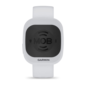
The Garmin MOB Tag with Quick Release Band adds an extra layer of safety for anglers who spend long days running open water, trolling structure, or navigating rough conditions. This wireless man-overboard tag pairs with compatible Garmin chartplotters...
))/2884169.json)
With routable mapping for on- and off-road navigation plus global 2-way messaging, the Garmin Montana 700i Handheld GPS Unit keeps you connected to the trail and each other. A massive 5 color touchscreen is incredibly easy to see w
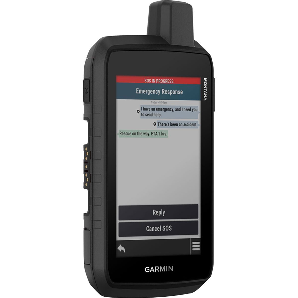
"What Our Gearhead® Experts Are Saying:""I brought the Montana 710i on a week-long backcountry route where cell service was nonexistent, and the inReach satellite messaging meant my family could follow along without worry. The large touchscreen reads...
))/2884170.json)
With routable mapping for on- and off-road navigation plus global 2-way messaging, the Garmin Montana 750i Handheld GPS Unit keeps you connected to the trail and each other! A massive 5 color glove-friendly touchscreen is incredibl

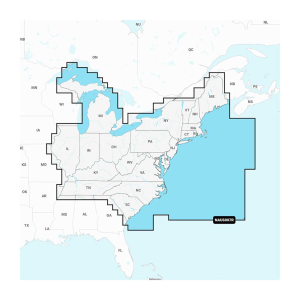
The Garmin Navionics+ cartography, designed for Garmin devices, provides detailed and up-to-date marine and lake charts, perfect for coastal and inland navigation. These charts offer integrated Garmin and Navionics content, ensuring exceptional coverage,...

The Garmin Navionics+ cartography, designed for Garmin devices, provides detailed and up-to-date marine and lake charts, perfect for coastal and inland navigation. These charts offer integrated Garmin and Navionics content, ensuring exceptional coverage,...

The Garmin Navionics+ cartography, designed for Garmin devices, provides detailed and up-to-date marine and lake charts, perfect for coastal and inland navigation. These charts offer integrated Garmin and Navionics content, ensuring exceptional coverage,...
The Garmin Navionics+ cartography, designed for Garmin devices, provides detailed and up-to-date marine and lake charts, perfect for coastal and inland navigation. These charts offer integrated Garmin and Navionics content, ensuring exceptional coverage,...
))/3426455.json)
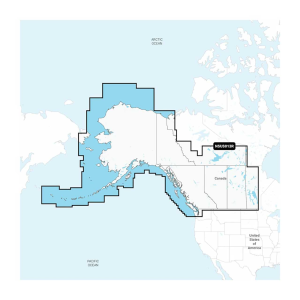
Plot your paradise with the best, most up-to-date Garmin Navionics+ Cartography Chart Card on your compatible Garmin chartplotter. For offshore or inland waters, this all-in-one solution offers detail-rich integrated mapping of coastal featu
))/3426459.json)
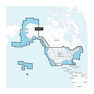
Plot your paradise with the best, most up-to-date Garmin Navionics+ Cartography Chart Card on your compatible Garmin chartplotter. For offshore or inland waters, this all-in-one solution offers detail-rich integrated mapping of coastal featu
))/3426457.json)
Plot your paradise with the best, most up-to-date Garmin Navionics+ Cartography Chart Card on your compatible Garmin chartplotter. For offshore or inland waters, this all-in-one solution offers detail-rich integrated mapping of coastal featu
))/3426458.json)
Plot your paradise with the best, most up-to-date Garmin Navionics+ Cartography Chart Card on your compatible Garmin chartplotter. For offshore or inland waters, this all-in-one solution offers detail-rich integrated mapping of coastal featu
))/3426460.json)
Plot your paradise with the best, most up-to-date Garmin Navionics+ Cartography Chart Card on your compatible Garmin chartplotter. For offshore or inland waters, this all-in-one solution offers detail-rich integrated mapping of coastal featu
The Garmin Navionics+ cartography, designed for Garmin devices, provides detailed and up-to-date marine and lake charts, perfect for coastal and inland navigation. These charts offer integrated Garmin and Navionics content, ensuring exceptional coverage,...
The Garmin Navionics+ cartography, designed for Garmin devices, provides detailed and up-to-date marine and lake charts, perfect for coastal and inland navigation. These charts offer integrated Garmin and Navionics content, ensuring exceptional coverage,...
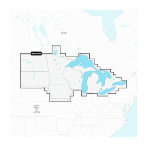
The Garmin Navionics+ cartography, designed for Garmin devices, provides detailed and up-to-date marine and lake charts, perfect for coastal and inland navigation. These charts offer integrated Garmin and Navionics content, ensuring exceptional coverage,...
The Garmin Navionics+ cartography, designed for Garmin devices, provides detailed and up-to-date marine and lake charts, perfect for coastal and inland navigation. These charts offer integrated Garmin and Navionics content, ensuring exceptional coverage,...

The Garmin Navionics+ cartography, designed for Garmin devices, provides detailed and up-to-date marine and lake charts, perfect for coastal and inland navigation. These charts offer integrated Garmin and Navionics content, ensuring exceptional coverage,...

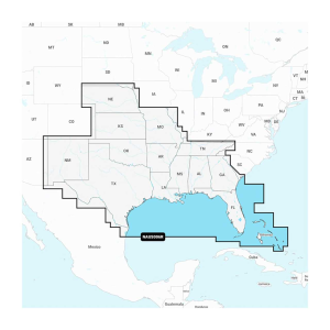
The Garmin Navionics Vision+ cartography stands out with its comprehensive coverage and advanced features, making it a top choice for anglers and boaters. Designed for both coastal and inland waterways, these charts offer high-resolution satellite imagery,...
The Garmin Navionics Vision+ cartography stands out with its comprehensive coverage and advanced features, making it a top choice for anglers and boaters. Designed for both coastal and inland waterways, these charts offer high-resolution satellite imagery,...
))/3463656.json)
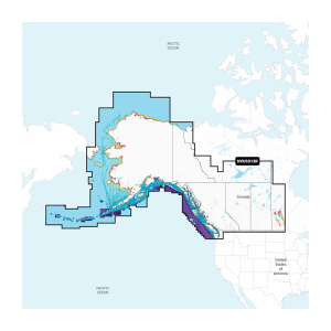
Plot your paradise with the best, most up-to-date Garmin Navionics Vision+™ Cartography Chart Card on your compatible Garmin chartplotter. For offshore or inland waters, this premium marine cartography card brings integrated, p
))/3463640.json)
Plot your paradise with the best, most up-to-date Garmin Navionics Vision+™ Cartography Chart Card on your compatible Garmin chartplotter. For offshore or inland waters, this premium marine cartography card brings integrated, p
))/3463685.json)
Plot your paradise with the best, most up-to-date Garmin Navionics Vision+™ Cartography Chart Card on your compatible Garmin chartplotter. For offshore or inland waters, this premium marine cartography card brings integrated, p