
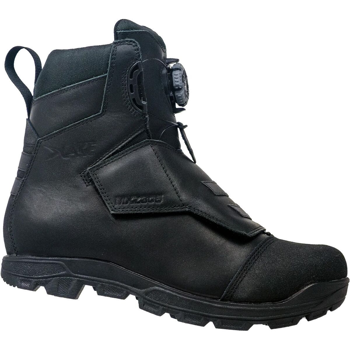
"What Our Gearhead® Experts Are Saying:""I was blown away by how the MXZ305 locks in warmth without feeling bulky. The leather upper feels tough and premium, and the BOA dial is super easy to adjust even with thick gloves on. It’s the shoe I trust...
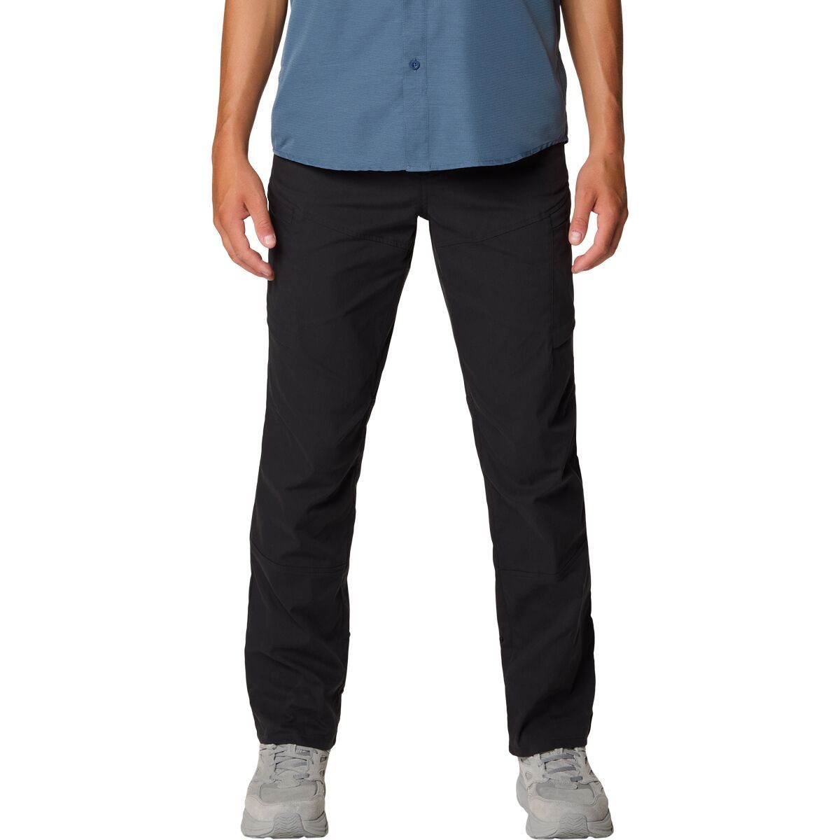
"What Our Gearhead® Experts Are Saying:""These pants strike the perfect balance between mobility and durability. The stretch-woven fabric moves with me whether I’m hiking or biking, and the secure zip pockets keep my essentials safe. The slim fit looks...
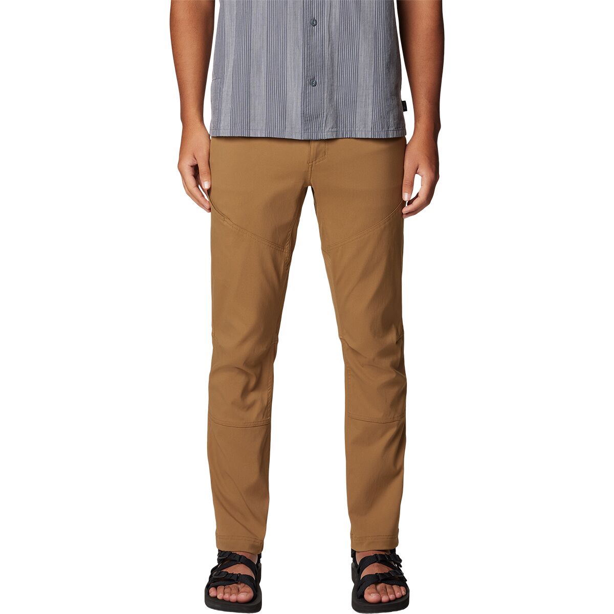
"What Our Gearhead® Experts Are Saying:""These cargo pants are a go-to for outdoor adventures and everyday wear. The peached woven fabric is soft but tough, with just the right amount of stretch for unrestricted movement. The zippered thigh pockets keep...
))/2719413.json)
Get 3 all-star elk calls in one convenient package with the Rocky Mountain Hunting Calls GTP 3-Pack DiaphragmElk Calls the #134 Black Magic, the #135 Reaper, and the #139 Spellbound. The Black Magic sports an advanced design that buglesike a frust
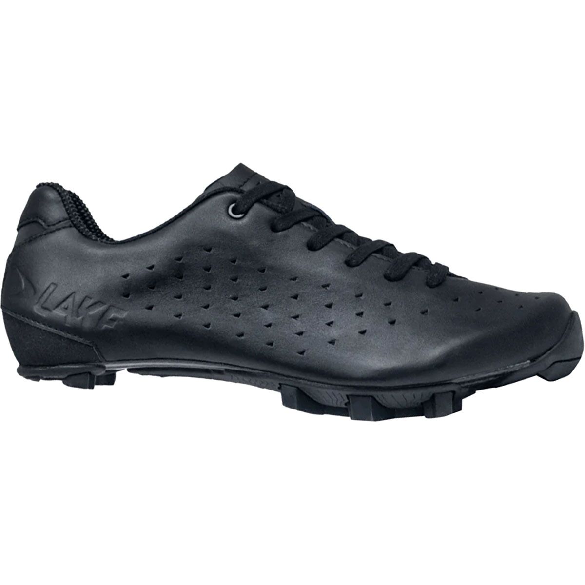
"What Our Gearhead® Experts Are Saying:""These shoes offer incredible comfort with their padded, wraparound upper. The laces give me an adjustable fit, and the carbon sole provides great power transfer on tough gravel rides. They're not the lightest,...

"What Our Gearhead® Experts Are Saying: ""I’ve been riding in the MX190 for a couple seasons, and it’s a workhorse. The combo of action leather and mesh keeps my feet cool on long climbs, and the ratchet buckle gives me a dialed fit that doesn’t...
"What Our Gearhead® Experts Are Saying: ""I’ve been riding in the MX190 for a couple seasons, and it’s a workhorse. The combo of action leather and mesh keeps my feet cool on long climbs, and the ratchet buckle gives me a dialed fit that doesn’t...

"What Our Gearhead® Experts Are Saying:""The MX239 builds on everything I loved about its predecessor, the MX238, but with an even better fit. The heel hold is noticeably improved thanks to the reinforced heel counter, and the BOA® dial placement allows...

SIDI has long been known for producing high-end road and mountain bike shoes, and the SIDI Aertis Mountain Clipless Shoe is no exception. Complete with a premium suede construction, a unique closure system, off-bike walking capability, and a super lightweight...
"What Our Gearhead® Experts Are Saying:""The MX239 builds on everything I loved about its predecessor, the MX238, but with an even better fit. The heel hold is noticeably improved thanks to the reinforced heel counter, and the BOA® dial placement allows...
))/2000703.json)
Navigate your favorite trails and find new ones to explore with the National Geographic National Forests Trails Illustrated Topographic Map Series. Providing incredible detail, these trail maps areabeled with mileage markers and are color
))/3222468.json)
Hey hikers, backpackers, and other wilderness explorers, the National Geographic Trails Illustrated Topographic Map Guide Series is the resource you'll want in your backpack while wandering unfamiliar trails. Certified Backcountry Tough, this fold-
))/2028187.json)
Navigate your favorite trails and find new ones to explore with the National Geographic National Forests Trails Illustrated Topographic Map Series. Providing incredible detail, these trail maps areabeled with mileage markers and are color
))/1754553.json)
Navigate your favorite trails and find new ones to explore with the National Geographic National Forests Trails Illustrated Topographic Map Series. Providing incredible detail, these trail maps areabeled with mileage markers and are color
))/984412.json)
Navigate your favorite trails and find new ones to explore with the National Geographic National Forests Trails Illustrated Topographic Map Series. Providing incredible detail, these trail maps areabeled with mileage markers and are color
))/3665183.json)
An easy-to-use power source for all your outdoor activities and more, Cabela's Outdoorsman Series 5,000W/4,000W RV-Ready Dual-Fuel Portable Generator with Electric Start and CO Shield delivers power you need, where you need it. Perfect for p
))/2326941.json)
Navigate your favorite trails and find new ones to explore with the National Geographic National Forests Trails Illustrated Topographic Map Series. Providing incredible detail, these trail maps areabeled with mileage markers and are color
))/2326944.json)
Navigate your favorite trails and find new ones to explore with the National Geographic National Forests Trails Illustrated Topographic Map Series. Providing incredible detail, these trail maps areabeled with mileage markers and are color
))/984415.json)
Navigate your favorite trails and find new ones to explore with the National Geographic National Forests Trails Illustrated Topographic Map Series. Providing incredible detail, these trail maps areabeled with mileage markers and are color
))/3079694.json)
Fish smarter with the help of the information packed inside the National Geographic Fishing and River Recreation Map Guide Series Maps. Each one includes detailed river maps at a scale of 1 for every half mile. At this scale, every bend and
))/2028186.json)
Navigate your favorite trails and find new ones to explore with the National Geographic National Forests Trails Illustrated Topographic Map Series. Providing incredible detail, these trail maps areabeled with mileage markers and are color
))/3079697.json)
Fish smarter with the help of the information packed inside the National Geographic Fishing and River Recreation Map Guide Series Maps. Each one includes detailed river maps at a scale of 1 for every half mile. At this scale, every bend and
))/1656093.json)
Navigate your favorite trails and find new ones to explore with the National Geographic National Forests Trails Illustrated Topographic Map Series. Providing incredible detail, these trail maps areabeled with mileage markers and are color
))/2326915.json)
Hey hikers, backpackers, and other wilderness explorers, the National Geographic Trails Illustrated Topographic Map Guide Series is the resource you'll want in your backpack while wandering unfamiliar trails. Certified Backcountry Tough, this fold-
))/1233116.json)
Hey hikers, backpackers, and other wilderness explorers, the National Geographic Trails Illustrated Topographic Map Guide Series is the resource you'll want in your backpack while wandering unfamiliar trails. Certified Backcountry Tough, this fold-