
"What Our Gearhead® Experts Are Saying:""These gloves offer a perfect balance of grip, durability, and breathability. The low-profile cuff makes them easy to slip on, and the touchscreen compatibility means I don’t have to take them off for quick phone...
"What Our Gearhead® Experts Are Saying:""These gloves offer a perfect balance of grip, durability, and breathability. The low-profile cuff makes them easy to slip on, and the touchscreen compatibility means I don’t have to take them off for quick phone...

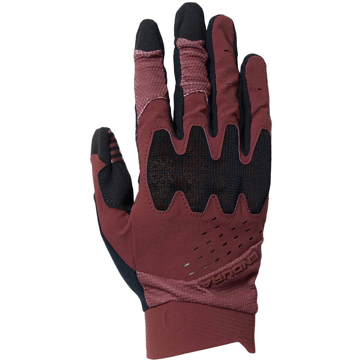
"What Our Gearhead® Experts Are Saying:""These gloves strike the perfect balance between comfort and protection. The gel padding absorbs vibrations on rough trails, and the hook-and-loop closure ensures a snug fit. They're breathable and lightweight,...
"What Our Gearhead® Experts Are Saying:""These gloves strike the perfect balance between comfort and protection. The gel padding absorbs vibrations on rough trails, and the hook-and-loop closure ensures a snug fit. They're breathable and lightweight,...
"What Our Gearhead® Experts Are Saying:""These gloves strike the perfect balance between comfort and protection. The gel padding absorbs vibrations on rough trails, and the hook-and-loop closure ensures a snug fit. They're breathable and lightweight,...

"What Our Gearhead® Experts Are Saying:""These gloves strike the perfect balance between comfort and protection. The gel padding absorbs vibrations on rough trails, and the hook-and-loop closure ensures a snug fit. They're breathable and lightweight,...

"What Our Gearhead® Experts Are Saying:""These gloves strike the perfect balance between comfort and protection. The gel padding absorbs vibrations on rough trails, and the hook-and-loop closure ensures a snug fit. They're breathable and lightweight,...

"What Our Gearhead® Experts Are Saying:""These gloves strike the perfect balance between comfort and protection. The gel padding absorbs vibrations on rough trails, and the hook-and-loop closure ensures a snug fit. They're breathable and lightweight,...

"What Our Gearhead® Experts Are Saying:""These gloves strike the perfect balance between comfort and protection. The gel padding absorbs vibrations on rough trails, and the hook-and-loop closure ensures a snug fit. They're breathable and lightweight,...
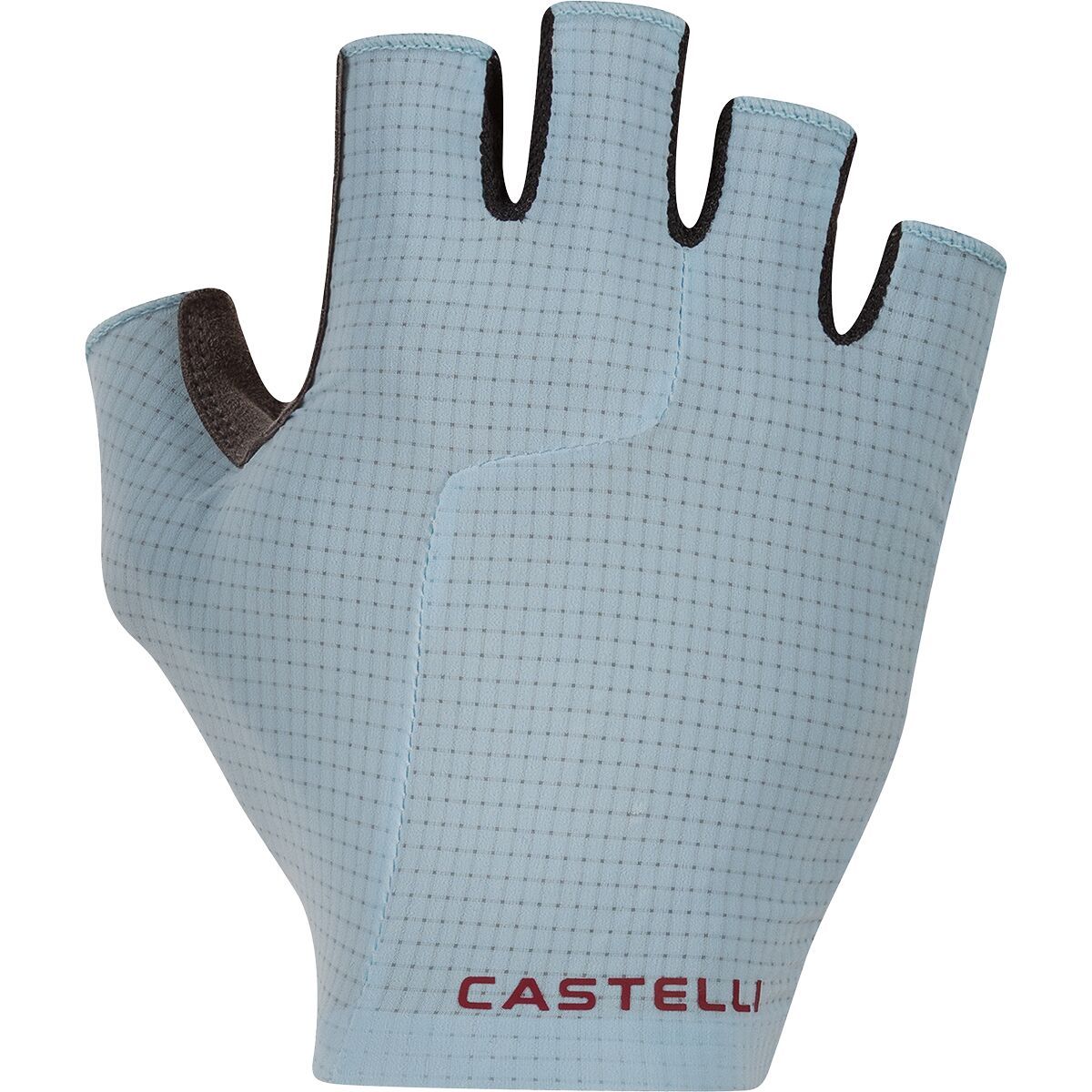
"What Our Gearhead® Experts Are Saying:""The Premio Evo Glove stands out for its seamless fit and comfort. The stretch woven back keeps my hands cool, while the Castelli Damping System (CDS) prevents numbness, even on long rides. Plus, the silicone palm...

"What Our Gearhead® Experts Are Saying:""The Premio Evo Glove stands out for its seamless fit and comfort. The stretch woven back keeps my hands cool, while the Castelli Damping System (CDS) prevents numbness, even on long rides. Plus, the silicone palm...

"What Our Gearhead® Experts Are Saying:""The Premio Evo Glove stands out for its seamless fit and comfort. The stretch woven back keeps my hands cool, while the Castelli Damping System (CDS) prevents numbness, even on long rides. Plus, the silicone palm...

"What Our Gearhead® Experts Are Saying:""The Premio Evo Glove stands out for its seamless fit and comfort. The stretch woven back keeps my hands cool, while the Castelli Damping System (CDS) prevents numbness, even on long rides. Plus, the silicone palm...
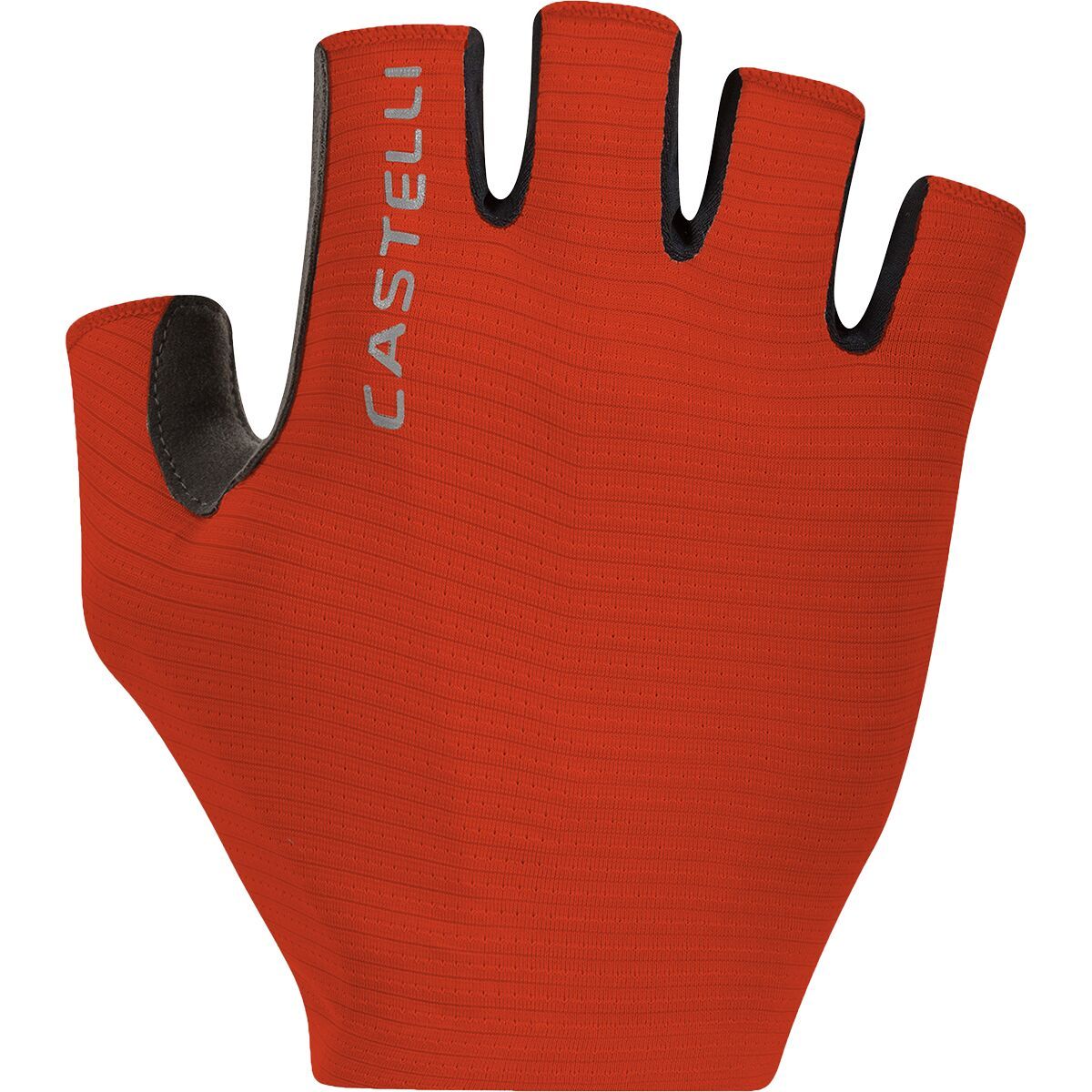
"What Our Gearhead® Experts Are Saying:""These gloves are all about control. The zero-padding design gives me a direct feel on the bars, while the D3O® Ghost® knuckle insert adds a layer of protection without bulk. The silicone print grips great, and...

"What Our Gearhead® Experts Are Saying:""These gloves are all about control. The zero-padding design gives me a direct feel on the bars, while the D3O® Ghost® knuckle insert adds a layer of protection without bulk. The silicone print grips great, and...

"What Our Gearhead® Experts Are Saying:""The Espresso Glove combines comfort and function perfectly. The Air-O stretch fabric keeps my hands cool on warm rides, and the Castelli Damping System (CDS) does wonders for reducing numbness on long routes....
"What Our Gearhead® Experts Are Saying:""The Espresso Glove combines comfort and function perfectly. The Air-O stretch fabric keeps my hands cool on warm rides, and the Castelli Damping System (CDS) does wonders for reducing numbness on long routes....

"What Our Gearhead® Experts Are Saying:""The Espresso Glove combines comfort and function perfectly. The Air-O stretch fabric keeps my hands cool on warm rides, and the Castelli Damping System (CDS) does wonders for reducing numbness on long routes....

"What Our Gearhead® Experts Are Saying:""The Espresso Glove combines comfort and function perfectly. The Air-O stretch fabric keeps my hands cool on warm rides, and the Castelli Damping System (CDS) does wonders for reducing numbness on long routes....

"What Our Gearhead® Experts Are Saying:""The Espresso Glove combines comfort and function perfectly. The Air-O stretch fabric keeps my hands cool on warm rides, and the Castelli Damping System (CDS) does wonders for reducing numbness on long routes....
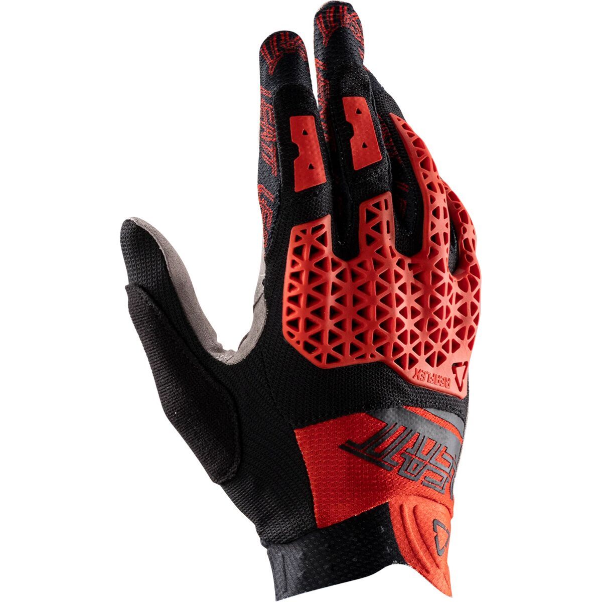
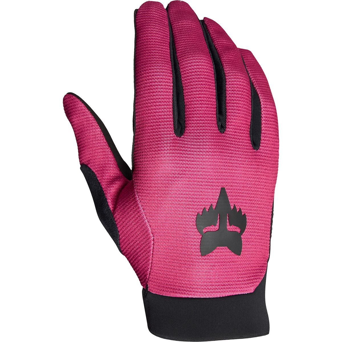
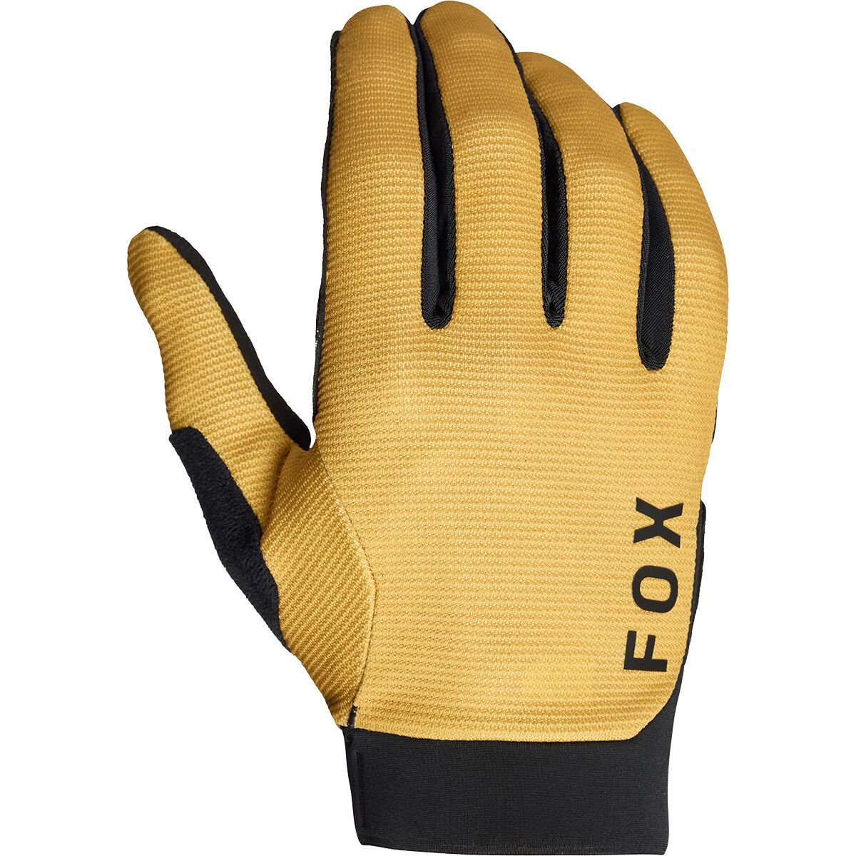
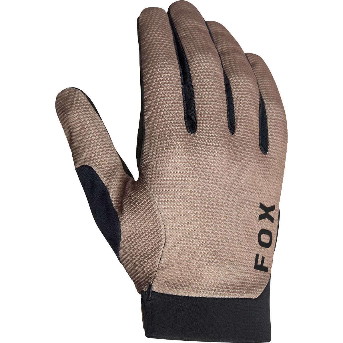
Expertly balancing lightweight bar feel with burly hand protection, the Leatt MTB 4. 0 Lite Glove is what we count on for days getting after on the trail without restricting our movement. NanoGrip technology on the palm provides a locked-in grip on the...

Expertly balancing lightweight bar feel with burly hand protection, the Leatt MTB 4. 0 Lite Glove is what we count on for days getting after on the trail without restricting our movement. NanoGrip technology on the palm provides a locked-in grip on the...

Expertly balancing lightweight bar feel with burly hand protection, the Leatt MTB 4. 0 Lite Glove is what we count on for days getting after on the trail without restricting our movement. NanoGrip technology on the palm provides a locked-in grip on the...